
Open Data Structures: An Introduction
Computer ScienceTextbook
Nature of Geographic Information
Not rated yetRate this bookDavid DiBiase’s Nature of Geographic Information explains the data, reference systems, institutions, and transformations behind geographic information science. The imported title added Systems; the source title is Nature of Geographic Information. Its nine chapters progress from data and scale to census mapping, topology, surveying, national infrastructure, remote sensing, and integration. The organizing question is how geographic evidence is produced before it reaches a map. Historical census and technical examples belong to the linked edition and should not be mistaken for current service specifications.
Read on the publisher’s website. Opens in a new tab.
 Free
About this book
David DiBiase’s Nature of Geographic Information explains the data, reference systems, institutions, and transformations behind geographic information science. The imported title added Systems; the source title is Nature of Geographic Information. Its nine chapters progress from data and scale to census mapping, topology, surveying, national infrastructure, remote sensing, and integration. The organizing question is how geographic evidence is produced before it reaches a map. Historical census and technical examples belong to the linked edition and should not be mistaken for current service specifications.
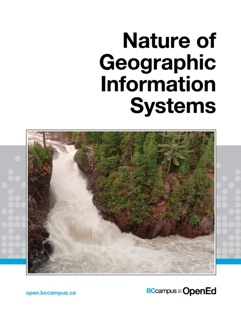
Cover: source-edition cover, displayed to identify the linked book. Publisher and third-party rights remain with their respective holders.
Book summary
About this book
David DiBiase’s Nature of Geographic Information explains the data, reference systems, institutions, and transformations behind geographic information science. The imported title added Systems; the source title is Nature of Geographic Information. Its nine chapters progress from data and scale to census mapping, topology, surveying, national infrastructure, remote sensing, and integration. The organizing question is how geographic evidence is produced before it reaches a map. Historical census and technical examples belong to the linked edition and should not be mistaken for current service specifications.
Chapter-by-chapter summaries
1. Data and information
Geographic data become information through organization and interpretation relative to a question. Location, attributes, time, measurement, and representation affect meaning. A map is a model shaped by inclusion, omission, and aggregation. Compare two representations of one place and identify their different choices. Distinguish the phenomenon from the database structure describing it. This makes later accuracy questions precise: useful evidence must be judged against its intended use rather than its visual polish alone.
2. Scales and transformations
Scale shapes detail and interpretation. Coordinate systems, reference surfaces, and projections transform location into usable representations with different distortions. No flat map preserves every property simultaneously. Choose according to the importance of area, shape, distance, or direction for the task. Preserve coordinate reference metadata. Zooming does not manufacture resolution or positional accuracy absent from the source. Compare transformations by what they preserve and what they alter instead of seeking a universally best projection.
3. Census data and thematic maps
Population attributes are linked with defined geographic units. Counts, rates, normalization, classification, and aggregation can change the pattern a map presents. A large count may reflect population size rather than high individual prevalence. Compare count and rate maps and explain their different questions. Explore how boundary and class-break choices alter interpretation. Avoid inferring an individual’s characteristics directly from an area average. Statistical geography is part of the analysis, not merely a convenient container for numbers.
4. TIGER, topology, and geocoding
Topology represents connectivity, adjacency, and containment beyond visual resemblance. TIGER illustrates structured data supporting census and mapping work. Geocoding links location descriptions such as addresses to spatial representations, sometimes using interpolation. Trace a match and identify uncertainty sources. A coordinate displayed with many decimal places can remain an estimate. Distinguish positional accuracy from successful matching, and inspect unmatched or ambiguous records rather than treating the resulting map as a complete account of input data.
5. Land surveying and GPS
Surveying and satellite positioning establish locations through measurements tied to reference frameworks. Accuracy depends on method, observations, environment, reference systems, and processing. Precision concerns consistency; accuracy concerns agreement with the relevant reference. Repeated measurements can cluster while sharing systematic error. Explain the pathway from observed signals or distances to a coordinate. Source-era examples teach concepts, while current equipment and correction-service performance require contemporary documentation rather than extrapolation from the textbook.
6. National spatial data infrastructure I
Infrastructure includes standards, metadata, organizations, policies, and access arrangements, not just downloadable files. Common frameworks make foundational data discoverable and reusable. Identify the agency maintaining a dataset, its update responsibilities, and the metadata required to evaluate fitness. A file without provenance or reference information can be difficult to integrate responsibly. The chapter places an individual project within collective systems that depend on institutional cooperation and sustained maintenance.
7. National spatial data infrastructure II
The discussion extends to framework information and compatibility across institutions. Similar layer names do not guarantee matching definitions, dates, or resolutions. Compare specifications before merging data. Ask who maintains each layer, how changes are communicated, and whether intended uses differ. Technical alignment needs institutional clarity. A project may display apparently seamless coverage while joining records collected under incompatible rules; documenting those differences is part of producing credible information.
8. Remotely sensed image data
Remote sensing interprets detected electromagnetic energy. Spatial, spectral, temporal, and radiometric resolution determine what can be inferred. A pixel is not directly a category such as forest; classification requires interpretation and validation. Compare collection dates, illumination, sensors, processing, and cloud effects before calling a difference landscape change. An impressive image remains evidence produced by a measurement system. Explain how the measured signal supports the specific claim about a feature or process.
9. Integrating geographic data
Layers can differ in reference, resolution, date, semantics, and uncertainty. Reprojection aligns coordinates without resolving every temporal or definitional mismatch. Define the question’s required features, dates, resolution, and tolerances before combining inputs. Trace how uncertainty could affect the final result. Integration is a judgment about compatible evidence, not a mechanical merge. Preserve provenance and unresolved limitations so another reader can assess what the output supports and where its apparent completeness exceeds its foundations.
Study instructions
- Specify geographic units, dates, variables, and acceptable uncertainty before collecting layers.
- Record reference system, scale or resolution, date, provenance, and restrictions for every input.
- Compare maps using different normalization and classification choices.
- Write an integration report identifying unresolved spatial, temporal, and semantic mismatches.
Questions for reflection
- Why can precise-looking coordinates be inaccurate?
- How can boundaries change a statistical pattern?
- Which mismatches survive reprojection?
Sources and coverage
This original reading guide covers the linked edition’s main chapters, or the principal sections of its two-chapter calculus text. Consult the source for full arguments, cases, worked examples, exercises, illustrations, and references. The source title is Nature of Geographic Information. Historical technical and institutional examples describe the linked edition. Read the source edition.
About access & copyright
This page provides book information and study material. Full-text access is provided by the original publisher or authorised source; a listing does not grant permission to republish the book.
Read our Library Access & Copyright policyExplore the contents
Check the chapters covered in this edition.
Visit the official source
See reading, preview or purchase options.
Save for later
Keep this textbook in your saved collection.
Reader ratings & reviews
Share your thoughts
Your review helps other students choose the right resources.
KEEP LEARNING
Your next great read
Computer Science
Foundations of Computation
Foundations of Computation
View Foundations of Computation — bookThink Bayes: Bayesian Statistics Made Simple
Think Bayes: Bayesian Statistics Made Simple
View Think Bayes: Bayesian Statistics Made Simple — book Computer Science
Python for Everybody: Exploring Data Using Python 3
View Python for Everybody: Exploring Data Using Python 3 — book Computer Science
An Introduction to Computer Networks
View An Introduction to Computer Networks — book Computer Science
Introduction to Computer Graphics
View Introduction to Computer Graphics — book Computer Science
Introduction to Programming Using Java
View Introduction to Programming Using Java — book Computer Science
Java with BlueJ Part 2
View Java with BlueJ Part 2 — book Computer Science
Java with BlueJ
View Java with BlueJ — book Computer Science