
Management in a Dynamic Environment
Built EnvironmentTextbook
Introduction to Space Syntax in Urban Studies
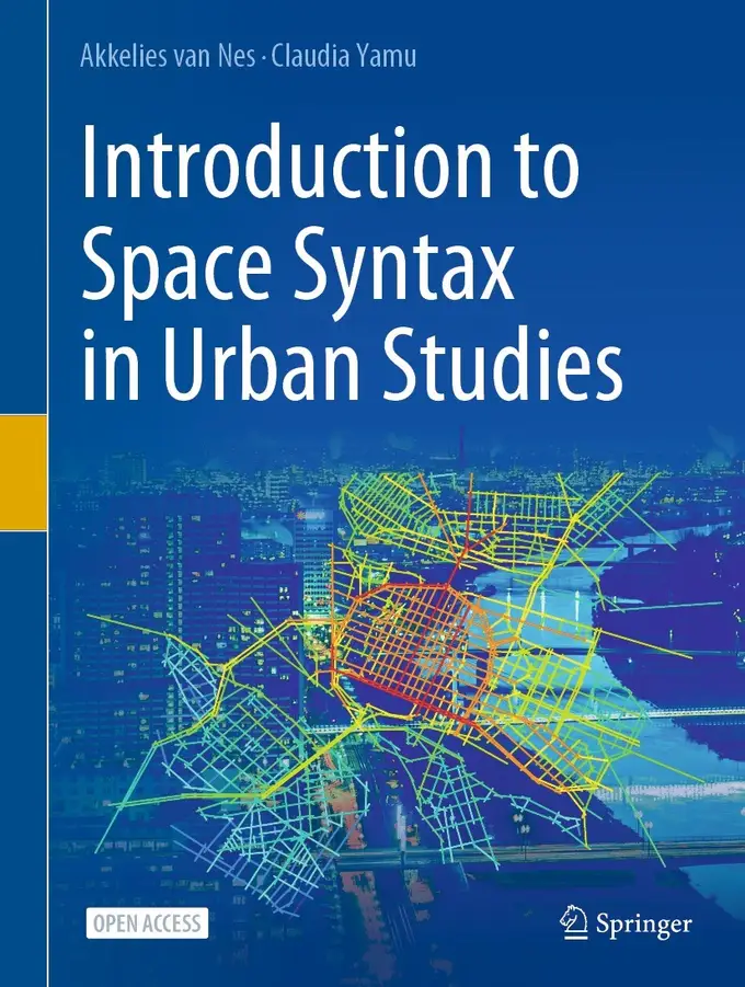
Not rated yetRate this bookAkkelies van Nes and Claudia Yamu’s Introduction to Space Syntax in Urban Studies explains how spatial configuration can be represented, measured and related to urban activity. Seven chapters connect research traditions, street networks, visibility, building–street interfaces, empirical methods, theory and design practice.
Free reading is available at the official source. Opens in a new tab.
 Free
About this book
Akkelies van Nes and Claudia Yamu’s Introduction to Space Syntax in Urban Studies explains how spatial configuration can be represented, measured and related to urban activity. Seven chapters connect research traditions, street networks, visibility, building–street interfaces, empirical methods, theory and design practice.
How to study this book
Choose a small study area and keep its boundary, map sources and representation decisions documented. Reproduce simple graph calculations before using software outputs. For each result, record the measure, distance definition and analysis radius, then compare it with observation. Treat a coloured map as a model requiring interpretation rather than as a direct photograph of social life.
Chapter-wise explanations and study tasks
Chapter 1 — Established Urban Research Traditions and the Platform for Space Syntax
Urban morphology, place-oriented approaches and street-network research offer different ways of understanding the built environment. The chapter introduces space syntax by clarifying what kind of spatial relationship it seeks to describe. A street’s role depends on its relation to the larger configuration as well as its local physical properties. Compare the questions each tradition can answer, rather than assuming that one representation contains every aspect of an urban place.
Study task: Describe one street through morphology, lived experience and network position, identifying a different question answered by each account.
Chapter 2 — Analysing Linear Spatial Relationships: Connectivity, Integration, and Choice
Connectivity concerns immediate links, integration describes relative accessibility in a configuration, and choice captures a form of through-movement potential. Axial and segment representations, angular analysis, normalisation and radius choices affect the results. These measures are related but not interchangeable. Work through a small network to understand the quantities before interpreting a city-scale map, and check boundary effects or mapping errors before treating a surprising value as an urban discovery.
Study task: Calculate simple connectivity and depth for a small graph, then explain why the most connected element need not be the most integrated.
Chapter 3 — Orientation and Wayfinding: Measuring Visibility
Isovists describe what can be seen from a position, while visibility graphs relate many positions across a space. The chapter connects these tools with orientation and movement, including agent-based exploration. Visual access is not identical to physical access, and a model depends on how obstacles and boundaries are represented. Analyse what the chosen method makes visible and what remains outside it, such as signs, prior knowledge or a person’s particular mobility needs.
Study task: Compare an isovist at two locations and explain how different visible areas could affect orientation without guaranteeing the same route choice for every user.
Chapter 4 — Private and Public Space: Buildings and Streets
Entrances, windows, intervisibility and the depth between private and public areas connect street configuration with everyday encounters. The chapter brings fine-grained building–street relationships into dialogue with larger network measures. A route with high movement potential may still have a very different social character depending on how buildings address it. Evaluate claims about surveillance or liveliness with observations and context, not simply a count of openings.
Study task: Survey two comparable street segments, recording entrances, visibility and transitions to private space, then relate those observations to their network positions.
Chapter 5 — Empirical Data Collection and Analysis, and Connecting Data with Space Syntax
Gate counts, snapshots, movement traces, interviews, surveys and secondary data can test and enrich spatial interpretations. The chapter connects qualitative and quantitative analysis, including coding, statistics and GIS-based combinations. A correlation is only as interpretable as the sampling, definitions and matching of spatial units behind it. Document when and where activity was observed, since a limited observation period may capture an event or schedule rather than a stable urban pattern.
Study task: Design an observation schedule and explain how you would align activity counts with spatial measures while accounting for time, land use and sampling limitations.
Chapter 6 — Theoretical Representations of the Built Environment
The authors connect space syntax to explanatory and interpretative research traditions, examining relationships among configuration, movement, economic activity and transformation. Theoretical claims need explicit scope: a recurring association is not a universal rule independent of culture or context. The chapter also explores centrality and sustainability, encouraging readers to connect mechanisms across scales. Distinguish a model’s explanatory proposal from the additional evidence needed to establish a causal relationship.
Study task: Reconstruct one theory as a chain of mechanisms, then identify a contextual factor that could alter one link without invalidating every part of the framework.
Chapter 7 — Space Syntax Applied in Urban Practice
The final chapter considers design through the question of what may happen if spatial relationships change. Practice examples, including Trafalgar Square and a proposed connection in Leiden, connect analysis with alternatives and lessons from earlier errors. A design model supports comparison rather than eliminating judgement about competing aims. State which outcomes a scheme is expected to improve and plan how those expectations could be checked after implementation.
Study task: Compare an existing network with a proposed connection, document the modelling choices and identify an observed outcome needed to evaluate the prediction.
Applied assignment
Produce a small urban study combining one network measure, one building–street or visibility analysis and a documented observation exercise. Explain map construction, boundary and radius choices, interpret mismatches between model and observations and propose one design alternative with a post-implementation evaluation plan.
Suggested reading plan
Read the research foundations first, then work through linear measures before visibility and building interfaces. Collect a small empirical dataset while reading Chapter 5. Finish with theory and practice, revisiting the same area to test how each chapter changes your interpretation.
Questions for reflection
- Which results arise from the city, and which depend on how the model was constructed?
- How do local connectivity, relative accessibility and through-movement potential differ?
- What evidence would challenge a design prediction based on a spatial map?
Edition and source notes
Based on the seven-chapter 2021 Springer textbook by van Nes and Yamu. These original explanations follow the main chapter sequence and connect the included methods and practice cases. Software workflows can vary; report the actual settings used rather than assuming that default outputs are comparable across analyses.
About access & copyright
This page provides book information and study material. Full-text access is provided by the original publisher or authorised source; a listing does not grant permission to republish the book.
Read our Library Access & Copyright policyExplore the contents
Check the chapters covered in this edition.
Visit the official source
See reading, preview or purchase options.
Save for later
Keep this textbook in your saved collection.
Reader ratings & reviews
Share your thoughts
Your review helps other students choose the right resources.
KEEP LEARNING
Your next great read
Basic models of the enterprise
 college
Prose Fiction: An Introduction to the Semiotics of Narrative
View Prose Fiction: An Introduction to the Semiotics of Narrative — book Collective choice
Models in Political Economy: Collective Choice, Voting, Elections, Bargaining, and Rebellion
View Models in Political Economy: Collective Choice, Voting, Elections, Bargaining, and Rebellion — book Cultural Rights
Non-Territorial Autonomy
View Non-Territorial Autonomy — book Business enterprises—Finance
The Brownian Motion
View The Brownian Motion — book Analysing multimedia data
Doing Qualitative Data Analysis with NVivo
View Doing Qualitative Data Analysis with NVivo — book Education
al Data Analytics for Teachers and School Leaders
View Educational Data Analytics for Teachers and School Leaders — book charged particle motion in Earth’s magnetosphere
Physics of Earth’s Radiation Belts
View Physics of Earth’s Radiation Belts — book global change
Marine Mammals
View Marine Mammals — book Classical mechanics