
Environmental Toxicology
design of water areasTextbook
Ports and Terminals
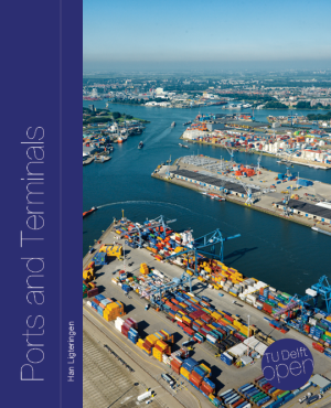
Not rated yetRate this bookHan Ligteringen's Ports and Terminals connects maritime transport with port planning, water areas, and cargo-specific facilities. Fourteen chapters cover general methods and container, general-cargo, Ro/Ro, liquid-bulk, dry-bulk, fishery, marina, and inland-waterway terminals. This guide also covers the adaptive-planning MV2 case and emphasizes system capacity, site evidence, uncertainty, and operational trade-offs.
Free reading is available at the official source. Opens in a new tab.
 Free
About this book
Han Ligteringen's Ports and Terminals connects maritime transport with port planning, water areas, and cargo-specific facilities. Fourteen chapters cover general methods and container, general-cargo, Ro/Ro, liquid-bulk, dry-bulk, fishery, marina, and inland-waterway terminals. This guide also covers the adaptive-planning MV2 case and emphasizes system capacity, site evidence, uncertainty, and operational trade-offs.
Chapter-wise summaries and study tasks
Chapter 1 Introduction
Ports connect maritime transport with land-based activities through facilities, operations, institutions, and decisions about space. The introduction establishes the scope of port and terminal planning and the need to connect hydraulic, nautical, logistical, and economic reasoning. A port layout is not an isolated drawing: it serves particular vessels, cargo flows, users, and transport connections. The book's engineering perspective requires explicit design assumptions and awareness of the wider system. Read its examples as source-edition illustrations rather than current fleet statistics or a ready-made design standard. Start with function and constraints before selecting dimensions.
Study task. Prepare a fictional port brief identifying users, cargo, vessel needs, hinterland connections, constraints, and missing data. Separate the planning question from a detailed structural-design task.
Chapter 2 Maritime Transport
Maritime transport creates demand for different port facilities through cargo characteristics, vessel types, and trading arrangements. Capacity measures and dimensions describe different properties: cargo volume or mass, displacement, draft, length, and beam should not be substituted for one another. Container, general-cargo, roll-on/roll-off, tanker, and bulk vessels impose different handling and access requirements. Liner and tramp services also create different patterns of arrivals and uncertainty. The chapter connects shipping information with port planning rather than treating a representative ship as a complete forecast. Historical graphs show context but need updating before an actual project uses them.
Study task. Compare three fictional vessel-cargo combinations, listing relevant capacity measures, dimensions, arrival patterns, and terminal implications. Explain why one ship-size figure cannot determine the entire port design.
Chapter 3 Port Functions and Organisation
Port functions extend beyond transferring goods across a quay. Storage, processing, distribution, services, and links in the transport chain shape the economic and operational role of a facility. Organization determines how public authorities, infrastructure providers, terminal operators, and other parties divide responsibilities. A bottleneck outside a terminal can limit the value of additional quay capacity. The chapter therefore links governance and logistics with physical planning. Distinguish ownership, regulation, operation, and service provision, and identify who can make the changes assumed in a proposed improvement.
Study task. Map a fictional cargo's journey through ship, terminal, storage, and hinterland transport. Assign responsibilities and identify a bottleneck that cannot be solved solely by adding berth length.
Chapter 4 Port Planning Methodology
Planning moves from purpose and forecasts through functional requirements, site information, alternatives, evaluation, and optimization. Cargo projections and shipping scenarios should be explicit about assumptions rather than hide uncertainty in one demand curve. Permits, legal frameworks, environmental effects, financial viability, and economic benefits concern different tests and stakeholders. An option can be financially attractive to an operator while producing wider costs or benefits not captured in its cash flow. Sustainable and adaptive planning consider long-term consequences and uncertainty. The chapter encourages a staged, revisable process with a clear definition of success rather than immediate commitment to a single layout.
Study task. Compare two fictional expansion alternatives using technical, financial, economic, environmental, and flexibility criteria. Identify a load-bearing forecast assumption and a future observation that would trigger reassessment.
Chapter 5 Planning and Design of the Water Areas
Water-area design connects vessel maneuverability with channels, turning areas, basins, and berths. Required width and depth depend on more than static vessel dimensions: motion, clearance, environmental conditions, navigation, and operational assumptions matter. Waves and basin response influence berth usability, while sediment transport and siltation affect maintenance and access over time. A layout may move a hydraulic or morphological problem rather than remove it. Use source equations with their conditions and recognize where simulation, measurements, or specialist guidance are required. A simplified classroom calculation does not establish a safe navigational design.
Study task. Create a conceptual design matrix for a fictional approach channel and basin, identifying vessel, wave, current, clearance, maneuvering, and sediment data. Explain which questions require specialist analysis beyond a preliminary estimate.
Chapter 6 Planning and Design of Port Terminals
Terminal planning relates services and components to capacity, dimensions, and operational performance. Maximum theoretical throughput is different from a usable or economic operating level. Ship service, transfer, storage, and land connections form an interacting system, so enlarging one component may shift congestion elsewhere. Quays, jetties, and terminal areas must fit cargo, equipment, vessel mix, and service expectations. Time variability and occupancy influence waiting and reliability. The chapter establishes general reasoning that later terminal-specific chapters develop. State the capacity definition and period before comparing alternatives or reporting a utilization figure.
Study task. Draw a fictional terminal process and calculate a simple component-capacity comparison with stated assumptions. Identify the bottleneck and explain why maximum capacity alone does not establish an acceptable service level.
Chapter 7 Container Terminals
Container terminals coordinate ship-to-shore handling, internal transport, yard storage, transfer areas, gates, and sometimes rail or inland-waterway services. Container sizes, flows, modal split, dwell time, equipment, and operating systems influence space and capacity. Larger ships can concentrate demand into peaks that an annual throughput average conceals. The chapter connects equipment arrangements and terminal archetypes with layout development, including quay length, cranes, apron, yard, buildings, automation, simulation, and security. Evaluate the full process rather than select automation as a universal improvement. Source-era fleet and throughput examples require separate updating for real projects.
Study task. Develop a fictional container-flow diagram with peaks, dwell time, and modal split. Compare two handling arrangements and explain effects on yard space, transfer conflicts, reliability, and the value of simulation.
Chapter 8 General Cargo and Multipurpose Terminals
General cargo and multipurpose terminals handle goods whose dimensions, packaging, handling needs, and storage requirements can vary substantially. This flexibility changes the relationship between berth service, equipment, covered storage, open areas, and transport access. A single average handling rate can conceal a difficult cargo mix or an operational conflict. Planning berth numbers and quay length requires attention to arrivals and service variability as well as annual tonnage. Multipurpose arrangements can improve flexibility while complicating scheduling and shared-resource use. Match the facility's capabilities with expected cargo rather than assuming container-terminal assumptions transfer unchanged.
Study task. Compare two fictional general-cargo mixes with the same tonnage. Identify different handling, weather protection, storage, equipment, and berth-service requirements before proposing a multipurpose layout.
Chapter 9 Ro/Ro and Ferry Terminals
Roll-on/roll-off and ferry terminals depend on movement between ship and shore through ramps, bridges, vehicle routes, and holding areas. Passenger and freight operations can create different circulation, safety, and processing requirements. Water-level changes, vessel geometry, ramp gradients, and maneuvering conditions affect the interface. Arrival peaks may make staging and land access as important as the berth itself. The chapter also examines bottom protection and other special design aspects. A functional layout should separate incompatible movements and identify where queues form rather than merely provide a short route from gate to ship.
Study task. Sketch a fictional ferry terminal with passenger, vehicle, and freight flows. Identify staging needs, conflict points, water-level effects, and information required before selecting a ramp arrangement.
Chapter 10 Liquid Bulk Terminals
Liquid-bulk terminals must match vessel interfaces and handling systems with product properties and risk. Tankers and gas carriers create different requirements, while terminal location, storage, pipelines, berth layout, jetties, and dolphins form a connected system. Offshore mooring arrangements offer alternatives with different operational and environmental implications. Safety cannot be reduced to a single separation distance copied from an example. Identify the substance, operating conditions, transfer process, emergency arrangements, and applicable specialist requirements. The source develops planning concepts, not a substitute for current hazardous-installation standards or a site-specific safety case.
Study task. Compare conceptual shore-based and offshore arrangements for a fictional liquid cargo. Map product flow and hazards, list required specialist studies, and explain why a generic berth drawing cannot establish safety.
Chapter 11 Dry Bulk Terminals
Dry-bulk terminals combine ship loading or unloading with transport, stockpiling, reclaiming, and sometimes blending or processing. Grabs, pneumatic systems, conveyors, bucket elevators, slurry systems, and self-unloading vessels fit different commodities and conditions. Material behavior, dust, moisture, weather sensitivity, and environmental effects influence selection. The slowest or least reliable link can limit the complete operation even where individual equipment has a high rated capacity. Storage also provides operational buffering rather than simply occupying spare land. Compare alternatives by the full cargo path, maintenance needs, variability, and consequences of an interruption.
Study task. Build a fictional dry-bulk handling chain and compare two unloading technologies against material properties, capacity, reliability, dust, and weather. Identify a failure that would constrain the entire terminal.
Chapter 12 Fishery Ports
Fishery ports range from simple landing places to facilities serving coastal, near-distance, or ocean-going fleets. Vessel needs, catch handling, unloading, service facilities, access, and organization differ across these contexts. The condition and timing of landed products can make coordination especially important. Site selection and basin or berth planning should reflect the actual fleet and supporting activities rather than a scaled-down commercial-cargo template. The chapter connects infrastructure with management responsibilities. A facility's usefulness depends on how boats, products, people, and services interact during peak periods, not only on whether vessels physically fit.
Study task. Prepare a fictional fishery-port flow map from vessel arrival to product departure, including services and peak timing. Explain how fleet type changes access, berth, unloading, and management requirements.
Chapter 13 Marinas
Marinas serve recreational vessels and their users, creating requirements for access, maneuvering, berthing, services, and shoreside facilities. Yacht dimensions and operating characteristics differ from those of large merchant ships, while user experience and safe circulation remain important. Basin layout and structures must respond to exposure, water levels, vessel mix, and maintenance. A dense arrangement of berths can increase nominal capacity while worsening maneuverability or service. Connect the water and land components and examine seasonal or peak use. The chapter provides planning concepts rather than a universal set of dimensions for every coast or vessel.
Study task. Compare two fictional marina layouts for the same vessel mix, considering maneuvering, exposure, access, services, maintenance, and peak use. Identify what data are needed before dimensioning berths.
Chapter 14 Ports and Terminals for Inland Water Transport
Inland-waterway ports connect vessel operations with rivers, canals, and land transport networks. Vessel classes, waterway restrictions, river levels, currents, and access determine feasible service. Open river ports and enclosed arrangements create different opportunities and constraints. Cargo terminals, handling, storage, passenger facilities, and connections with seaports require their own functional analysis. Large seasonal level changes can strongly affect the berth interface and operating availability. A design suitable for a tidal seaport cannot be transferred automatically. State the waterway, vessel, hydrological, and cargo assumptions before drawing conclusions from an example.
Study task. Develop a fictional inland-port brief with vessel class, seasonal levels, access restrictions, cargo, and land connections. Compare an open-river and enclosed option and identify the principal operational trade-off.
Adaptive Port Planning applied to port expansion project MV2
The MV2 case applies adaptive planning to a real port-expansion context presented in the source. It moves from project objectives and assumptions toward identifying vulnerabilities, increasing flexibility and robustness, evaluating alternatives, monitoring, and contingency planning. The value of the case lies in its reasoning process rather than treating its original forecasts as current conditions. Assumptions can be important even when they concern developments outside the project's control. A monitor should connect an observable change with a feasible response, not merely collect information. Compare actions taken now with options preserved for later and explain the cost of waiting or committing.
Study task. Adapt the case's logic to a fictional expansion: list assumptions, vulnerabilities, robust actions, options, indicators, and contingency triggers. Explain how the plan changes if a major demand assumption fails.
How to study this book
- Begin with a vessel-cargo-service brief and distinguish forecast assumptions from measured site conditions.
- Trace the complete transport chain and identify bottlenecks before selecting a single facility dimension.
- Keep units, time periods, capacity definitions, and peak versus average conditions explicit.
- Compare layouts through operations, economics, environment, maintenance, and flexibility rather than geometry alone.
- Use source examples for education; obtain current standards, vessel information, surveys, and specialist review for actual engineering work.
Questions for reflection
- Which component limits the whole system?
- Does an apparent capacity improvement worsen waiting or reliability elsewhere?
- What assumption makes the selected layout preferable?
- Which future changes can be monitored and addressed without abandoning the entire plan?
Source edition and coverage
The guide follows the fourteen chapters and MV2 adaptive-planning case in the linked TU Delft online edition, published in 2021 as a digital copy of the 2017 print version. Fleet statistics, guidelines, and examples belong to that source context and are not presented as current design approvals or site-specific engineering advice. These are original study explanations and learning tasks. Read the complete book at the official source.
About access & copyright
This page provides book information and study material. Full-text access is provided by the original publisher or authorised source; a listing does not grant permission to republish the book.
Read our Library Access & Copyright policyExplore the contents
Check the chapters covered in this edition.
Visit the official source
See reading, preview or purchase options.
Save for later
Keep this textbook in your saved collection.
Reader ratings & reviews
Share your thoughts
Your review helps other students choose the right resources.
KEEP LEARNING
Your next great read
Chemistry
Vaccination Programmes
Vaccination Programmes
View Vaccination Programmes — bookRelativistic Quantum Mechanics
Relativistic Quantum Mechanics
View Relativistic Quantum Mechanics — bookAerospace Structures
Aerospace Structures
View Aerospace Structures — book Abelian number fields
Number Fields
View Number Fields — book Textbook
Agricultural Meteorology and Climatology
View Agricultural Meteorology and Climatology — book Language teaching and learning
In the Community: An Intermediate Reading and Writing Textbook
View In the Community: An Intermediate Reading and Writing Textbook — book Communication Studies
Technical Writing Essentials 2nd Edition
View Technical Writing Essentials 2nd Edition — book Language learning for academic, technical and scientific purposes
Technical Communication in Engineering: A Place-Based Approach
View Technical Communication in Engineering: A Place-Based Approach — book mathematical modelling